
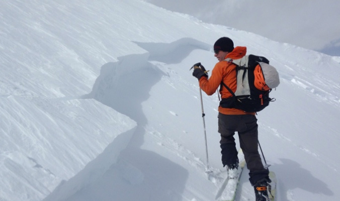
Windslab seems to be the snowpack story for winter 2017, with a layer cake of instabilities forming in many places across the west. With slabs on slabs on slabs, skiers can trigger deep avalanches if one weak layer steps down to the many others lurking beneath. Here is the avy report for this week.
Crested Butte Avalanche Center (CBAC)/Colorado Avalanche Information Center (CAIC)
More windslab plagues Colorado, thanks to new snow and high winds, and the CAIC warns of slab that could be up to four feet deep in certain areas on The Western Slopes. Weak layers near the top of the snowpack have been building over recent weeks, and each slab is creating a layer cake of instabilities that could step down.
“Avoid being on or under any slope with more than about 10 inches of new snow from this past series of storms; this includes almost every steep slope on the west side of the zone,” cautions the CAIC for the Gunnison area.
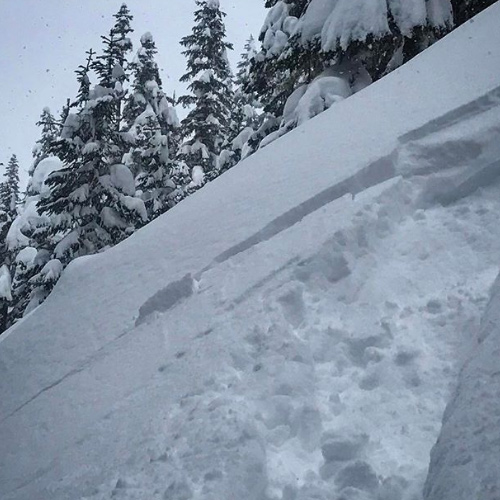
An avalanche was triggered on surface hoar and caught a skier in the Gunnison area on February 20. [Photo] Courtesy CAIC
Find out more about Colorado avalanche conditions at avalanche.state.co.us and cbavalanchecenter.org.
Northwest Avalanche Center (NWAC)
For most of the area under the purview of the NWAC, the avalanche danger is listed as moderate, with recent rain and sun crusts causing issues in the snowpack. A wet storm that came in on Valentine’s Day was followed by a foot of new snow and wind, causing windslabs, especially near ridges. A new storm system predicted to arrive Tuesday afternoon could bring added snow, wind and additional instabilities.
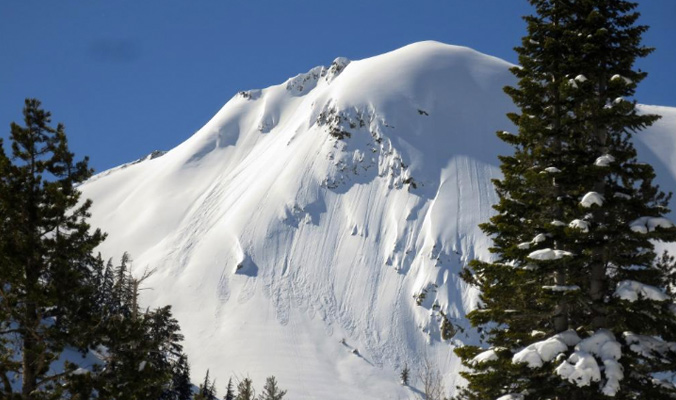
Snoqualmie Mountain observation on February, 28. [Photo] Courtesy NWAC
The NWAC warns, “Mt Hood pro patrol reported widespread natural and triggered wind and storm slabs Tuesday morning, especially near and above tree line. Avalanches occured even on relatively low angled terrain. Over two feet of new snow has accumulated in the past 24 hours with strong winds near and above tree line, creating very dangerous avalanche conditions. Travel in avalanche terrain is not recommended Tuesday.”
Find out more about conditions in the Pacific Northwest at nwac.us.
Utah Avalanche Center (UAC)
Up to two feet of snow has fallen in the Salt Lake area in the last few days, getting skiers fired up, but also bringing with it increased avalanche danger. All areas under the purview of the UAC are currently listed as having considerable avy danger, with wind at upper elevations being the primary reason for this forecast. Places out of the wind near tree line are rated as moderate, and below tree line as low.
“The Wasatch range went through a natural avalanche cycle yesterday during the high precipitation rates where long running new snow avalanches moved with ease,” the UAC reports Tuesday. “Backcountry riders reported that slope cuts easily produced long-running loose dry avalanches all confined to the new snow. Avalanche control teams also confirmed that loose dry avalanches were running long distances and some deep enough to bury a person.”
Find out more about conditions in Utah at utahavalanchecenter.org.
Gallatin National Forest Avalanche Center (GNFAC)
New snow in the last 24 hours has created a moderate avy danger rating for most areas in Montana. 40-mile-an-hour winds whistled through the region last night and so areas that are wind affected are of more concern, with protected zones out of the wind currently rated as having low avy danger in the Bridger and Cooke City areas. The Madison Range, Gallatin Range and Lionhead areas near West Yellowstone are rated as considerable on all slopes and elevations.
Find out more about conditions in Montana at mtavalanche.com.
Bridger Teton National Forest Avalanche Center (BTAC)
In Wyoming, all areas are currently listed as having considerable avalanche danger due to recent snowfall accompanied by wind at higher elevations. The BTAC cautions skiers to stay away from steep chutes and bowls that could be more wind affected. Below tree line the avalanche danger is listed as low.
“Pockets of wind slab formed by west to southwest winds could be triggered by humans in steep, wind loaded avalanche terrain at the mid and upper elevations,” the BTAC explains. “These slabs are likely to be six to 18 inches in depth but could be up to two feet deep in some upper elevation avalanche starting zones.”
Find out more about conditions in Wyoming at jhavalanche.org.
Sierra Avalanche Center (SAC)
Windslab, windslab, windslab. Everyone out west is struggling with the same issues. In the Sierra, the considerable avalanche danger is due to snow being transported onto on NW-N-NE-E-SE-S aspects.
The SAC warns, “Areas of instability will likely exist within surrounding areas of seemingly stable snow. Identify areas of recently wind drifted snow and avoid suspect slopes steeper then 35 degrees.”
In addition to wind, some slopes were experiencing warming in the Sierra on February 28. [Photo] Courtesy SAC
—
As the winter progresses, it’s important to keep an eye on snowpack trends and instabilities. This is not a complete guide to avalanche forecasts, so stay informed and educated by visiting local avalanche forecasting websites and get educated about avalanche safety through programs like Know Before You Go, the Mountain Academy hosted by Salomon and Atomic and through nationwide courses offered by the American Institute for Avalanche Research and Education (AIARE).


Related posts: