
Exploring new territory often requires finding a source for good beta. Maps, routes and terrain intricacies all present questions that even local experts need at times. And with modern technology, there are a number of resources available to help make the process easier. But it can be tricky to wade through the abundance of digital observation data and the latest avalanche apps. Enter Rakkup, an application that takes guidebook content and modifies it to be mobile.
Why haven’t you heard of Rakkup until now? It has, until recently, been geared primarily toward climbers. But Nate Greenberg, a dedicated tele-skier based in Mammoth Lakes, Calif., saw this as an opportunity.
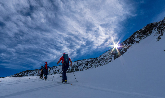
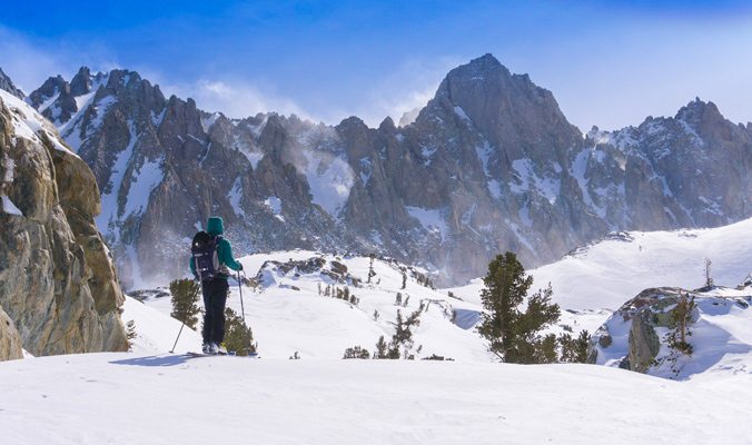
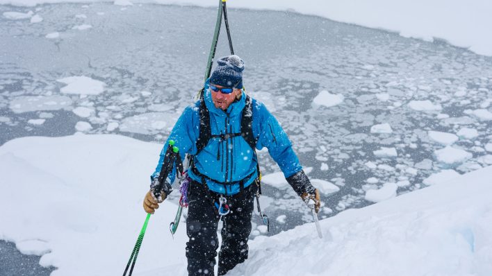
Husted navigates the skintrack with the new Rakkup app. [Photo] Nate Greenberg
To do this, he teamed up with Rakkup, which now boasts five backcountry ski guidebooks for California’s Eastern Sierra, Washington’s Mt. Baker, Wyoming’s Teton Pass, and Colorado’s Silverton and Crested Butte, Colo., converted to digital form from the original in-print book and all accessible through the app to purchase or rent. And while there are only a few guidebooks currently available, Greenberg hopes to add more in the future as he pursues authors and publications to join the network. But in the meantime, here’s what Rakkup offers.
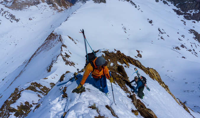
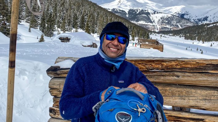
Digital guidebooks could make tricky summits more accessible. [Photo] Nate Greenberg
The Purpose
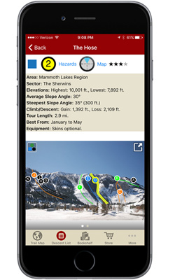
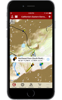
Rakkup is designed to facilitate safety and travel by listing peaks, routes, photos and in-depth descriptions of difficulty, hazard level and slope aspect of a given location. It also includes information like tour length, elevation, best time of year to go, known slidepaths, headwalls that may be dangerous and gear-selection tips, like noting whether or not you may need a rope, ice axe or crampons.
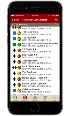
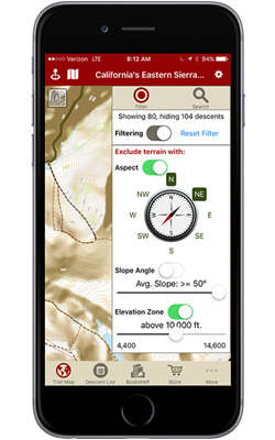
The app provides the added benefit of filtering search results depending on what a user is looking to do as well as avoid. If the avalanche report calls for more danger on northeast-facing slopes, a filter can show all other slopes and slope angles to avoid. The Rakkup team is currently working to take this technology a step further by providing an automatic update for terrain choices based on daily avalanche-center reports, and they hope to incorporate user reports into the mix in the future.
“My feeling of the app’s main purpose is that it connects people with appropriate terrain,” Greenberg says. “In general, guidebooks provide people with options in terrain with the hopes of helping people make good decisions relative to ability and the conditions of avalanche danger.”
Rakkup vs. Other Apps
Competition lurks around every corner of the app world, and certain Rakkup features overlap with those of Mountain Hub—which crowd-sources maps and routes for various sports like mountain biking, skiing and trail running—and Fat Map, which provides 3D imagery of backcountry zones and routes.
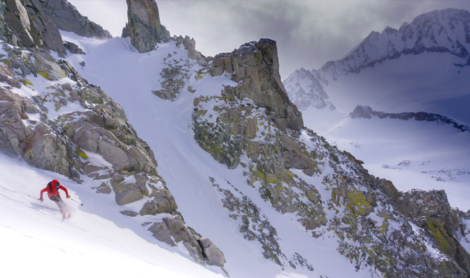
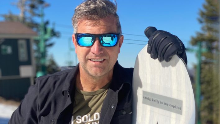
Rakkup may offer maps and observations, but pow slaying is still up to the skier. [Photo] Nate Greenberg
“We provide not just the lines on the map; we also [provide] content,” Greenberg says. “The copy, text, as well as the photos are all integrated; the platform is rich with multimedia from approaches to routes to difficulty levels.”
Rakkup vs. Traditional Guidebooks
While holding a physical book is appealing, guidebooks can be heavy and susceptible to damage from the elements—not ideal for bringing into the mountains. Rakkup is designed to accommodate for flexibility and travel.
Greenburg describes Rakkup as “just one tool of many,” and continues: “I think a lot of people are relying on different [tools] in the backcountry. You can’t use it [Rakkup] in isolation, but it’s a great tool to be used in conjunction with a lot of things such as topographic maps, cell phones and compasses.”
Bottom Line: Rakkup may not be the one-stop app for tourers, but it’s a helpful resource when traveling unfamiliar territory or to get professional avalanche and weather observations on the fly.
Rakkup helps make remote objectives more accessible. [Photo] Nate Greenberg


Thanks for a great write up, Trevor.