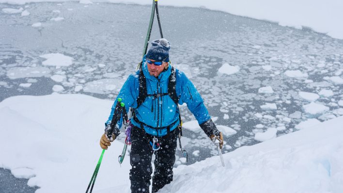
Chamonix-based IFMGA guide Ben Tibbetts is familiar with navigating the Mont Blanc massif, but when he ventures beyond his home base to explore new high-mountain, complex terrain, he can’t rely on memory to help him travel safely. For this reason, on a recent trip with a group of close friends to Greenland, Tibbetts looked to new navigational tools created by the company FATMAP to help him locate appropriate objectives and ski first descents.
Along the way, Tibbetts documented this journey on film to share the excitement of a remote adventure, the workings of a beautiful culture and the utility of FATMAP in making it all possible. We caught up with Tibbetts at home in Chamonix to find out more about the trip and about how he used the FATMAP program in the field. Here is what he had to say.
A Line in the Snow – Greenland from Ben Tibbetts on Vimeo.
Backcountry Magazine: Why did you go to Greenland?
Ben Tibbetts: Greenland is the poor man’s Antarctica. I have worked up in Greenland twice before back in 2012. It is vastly more accessible than the Antarctic, but the scale of wilderness and adventure is on a totally different scale from being in the Alps or being in the Rockies. It’s so far removed from everyday life that it’s one of those dream destinations. I definitely wanted to get back there to do a recreational trip; to go and explore new lines and have a good time with some friends.
BCM: Who were the people you traveled with?
BT: They are all really close friends of mine. It wasn’t a team of pro skiers. I ski 100 days in the Alps every year with some of these guys. Misha (Gopaul) is whom I do more than anything with—we race together, climb, mountaineer and do all kinds of stuff in Chamonix. He has been developing this FATMAP app for a few years now.
The original plan was to explore Greenland, and it was actually touch-and-go whether we could get the data in time for this trip, because it is actually quite a complicated process: extracting the data from the satellite company and then building the map, but Misha was an obvious choice, FATMAP or no FATMAP.
Another partner was Stewart (Johnston), who works as a lawyer in London, but has a lot of experience in the mountains. Like Misha and I, Stewart and I have done a lot of ski-mountaineering racing together as well as loads of climbing.
And Toto (Cox) was an obvious choice for the trip. My girlfriend was supposed to come along but she broke her leg right before we left, and I wanted to have a girl along, because I think it is important to have that feminine dynamic. Toto was a clear choice. She is someone who I have done a lot with in the mountains and she was keen to come along.
BCM: What is navigation in Greenland like?
BT: In the ’60s, the Danish mapped the vast majority of Greenland in reasonable detail on the level of a road Atlas. Since then, there have been a few more detailed maps, but really there is very little to go off of in terms of mapping. You more or less go into the mountains with a road atlas.
First off, I have a good friend who works out in Greenland and who gave us an idea of where to go, because, frankly, the maps are more of a guide to where the valleys are. They don’t really tell you anything at all past the bigger picture topography. So trying to find objectives out there before you go limits you to looking at photos of what people have skied before and seeing if you can find new lines in the pictures. There are not many photos out there to use like this, however.
So, this trip was an obvious opportunity to try and line up the FATMAP data and the precision of mapping that FATMAP can produce with the area that we wanted to visit, which is limited without throwing a helicopter into the equation. We weren’t able to use FATMAP before we got to Greenland, because it wasn’t until we had already arrived in Iceland and our flight out had been delayed that we managed to download the map just before we jumped on the plane to Greenland. It was a tense moment. We would not have been able to download a file like that in Greenland.
BCM: What was it like to have access to that kind of topographic detail when choosing lines to ski?
BT: It is a very cinematic idea—to be able to go and stand at the top of a mountain and drop in like some kind of hero freerider into a line that you haven’t skied before, you haven’t climbed up and you can’t see out of. It is the kind of stuff that you see in Alaska in the movies, but people don’t do that in real life. You usually have to scout a line meticulously. We didn’t have enough time to scout lines to that extent and then ski it the next day because both Stewart and Misha have jobs that they had to get back to. Misha has a three-month old child, so the whole trip had to take place within the span of two weeks. To maximize the time, we could have just booted up the same line we wanted to ski back down, but it is always more rewarding to do a through-route.
We had 80 square kilometers worth of data, so that was quite a bit of data from multiple companies, and where we had high-resolution terrain maps and high-resolution imagery, we were good to go for skiing. We knew the data was good when we could see every stone in a couloir. We knew exactly how steep it was going to be, the aspect, and as long as it didn’t go over 50 degrees (based on summer imagery), and retained a thread of snow—then we knew that the line was probably going to go. On the other hand, if the terrain model was at 30 meters rather than five, then that thread of snow could be an icefall, and we didn’t have that micro resolution. For our first objective, we decided not to go down because we would have had to thread the needle, and we didn’t know if it was safe or not, because the data resolution was not high enough.
We had to find that sweet zone with the maps to make good decisions about objectives. To do some lines as a first descent in such a wild place proved the worth of the mapping software to me.
BCM: How did FATMAP help with terrain and avalanche management?
BT: When we arrived, we arrived just after a big storm cycle, the one that had delayed our flight. In the higher areas, it had laid out some colder snow, and by the time we had gotten our gear together, gotten a boat northwards and then trekked into the mountains, in those few days, the snow stability got better. We were still cautious because we could see evidence of avalanche debris and crowns from the last storm cycle. In FATMAP, you can search for 30-35 degree slopes and that can tell you whether or not you are in avalanche terrain.
BCM: Do you use this technology back home in Chamonix?
BT: For me, skiing every day in the Alps is what I use FATMAP for the most. It is a ready reference that can tell you whether you are in, above or below avalanche terrain. If I have clients with me, it is critical information to know. If the weather is good and you know the area well, then you already know that stuff. But as soon as a cloud comes in and you are trying to deal with a standard map, it takes a while to figure out what the terrain above you means exactly. You have to leave very wide margins when traveling, because in the Alps, the terrain is really complicated. When I use FATMAP, the terrain detail can give you a much finer tool to thread the needle between two barriers.
BCM: What did you learn about Greenland’s culture while you were there?
BT: It is fascinating and engaging to see how the Inuit live in that wild landscape. For us, it was an alien environment. We poured over maps, dreaming about that kind of landscape, but you see people out there in the middle of winter—the sun won’t rise there for quite a while—and they go about their lives the way they have for generations. They live in wooden huts, small villages, and until recently, they largely lived off of seal meat and bear meat. To see that playing out is a moving experience. It is incredibly inspiring. Their economy is the original sustainable economy.


Related posts: