If you’re investing your savings in a ski vacation on the other side of the world, you’ll also want to invest your time in the research to make it the trip of a lifetime.
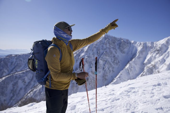
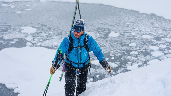
Armed with a mix of trip planning and local knowledge, Mo Rasiah points out the next objective. Iz La Motte
As clouds roll in outside Japan’s Hakuba Goryu Snow Resort, the visibility drops to just a few feet in front of my face, and the rest of our group comes in and out of view. I point my skis toward a distant tree where our guide, Mo Rasiah, has stopped and walk straight until the wind lifts the haze for a minute. Due to the weather, we’re at our high point of the day with a plan to ski out to the valley floor, a different route than how we ascended. As the rest of our group rips skins, Rasiah is on his phone, referencing maps and his notes from a morning planning session.
I have no idea how we’re getting down, but, as Rasiah told me on an earlier day, he does his homework. He’s a certified ski guide through the Association of Canadian Mountain Guides, and, over the past 20 years, he’s worked in Norway, Iceland, Chile, Argentina and, of course, Japan. Sometimes, like now, he’s working for international guide service PowderQuest. Other times, he’s running his own program through his company Crystalline Backcountry Guides. No matter where he goes, he takes extra time to research his destination’s snowpack, terrain and local resources.
Snow Tracking
In the U.S. and Canada, we navigate to avalanche.org or avalanche.ca, but, elsewhere around the world, similar resources might not exist or might be in another language. “I found that that can be really challenging in foreign countries as one, maybe they don’t have a system for that. Or two, you don’t know where to find that system,” says Steve Banks, an American internationally certified mountain guide. His work has taken him all over the world, to places like Canada, Japan, New Zealand, Iceland, France, Italy, Switzerland and Austria, just to name a few. When the forecast isn’t available, he has to make his own.
“We can make the generalizations about the different types of snowpack climate, whether it’s continental, intermountain or coastal,” says Banks. “Depending on where I’m going and if I know what type of snowpack climate I’m going into, that already lets me start thinking about what sort of problems I might see.” From there, Banks tracks weather, especially snowfall and temperature, to create his own avalanche forecast.
For Rasiah, prep starts a year before he works in a new country. “Ideally, I have lots of time to do my prep, as in, I can actually start following the country’s weather a winter before I actually get there, get my head around what the typical weather patterns are for the area,” he says. When available, he finds weather stations in the same area where he’s planning to go. While these are plentiful in North America, they can be harder to find in other parts of the world. In South America, Rasiah says there are very few, and while he can find them in Japan, all the data is in Japanese. Google Translate can give a decent English version, but it isn’t always accurate.
Banks says he’s also had success reaching out to the national weather forecasting system and asking for data. The HTML files they send him might be more granular than what the average backcountry skier needs, though. He and Rasiah both point to apps like Windy, which offer global point forecasts.
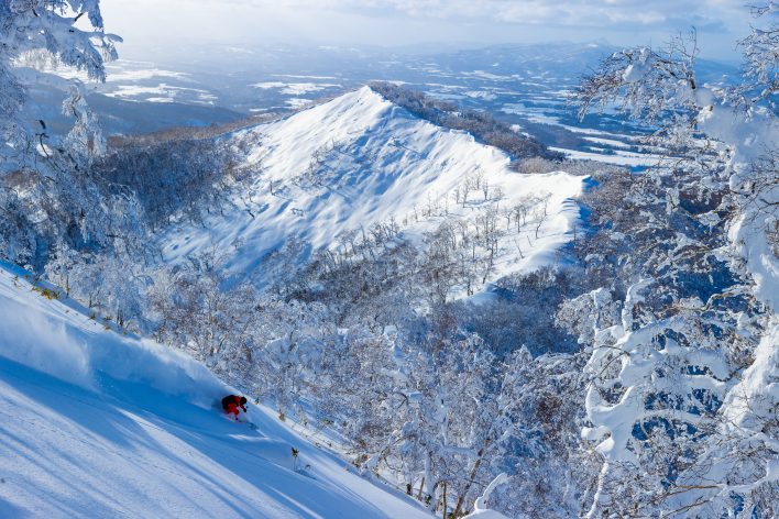
On a rare high-visibility day on Hokkaido, Ian Morrison splits time between making mental notes on terrain and skiing powder outside of Rusutsu. Grant Gunderson
Terrain Mapping
A decade ago, making a trip plan for a remote destination involved tracking down paper maps, which sometimes wouldn’t be available until you landed in the country. Today, mapping apps mean you can start trip planning as soon as you book your plane tickets.
“I like to do it online, and my go-to applications for that are Gaia and Cal Topo,” says Rasiah. Other digital mapping platforms include OnX Backcountry and Whympr. With mapping sites like these, you can create uptracks, descents and waypoints, plus add additional layers like slope-angle shading and sun exposure. Programs like Google Earth offer satellite imagery that can show the snowpack in different seasons. After you’ve built your trip catalog, you can even print your map as a PDF or export it to the accompanying app on your phone.
Rasiah adds that, because forecasting in remote locations is often partly guesswork, his route catalog is more robust and offers options for a variety of scenarios. “Every day it’s important for me to go out with a plan A, plan B and plan C,” he says. “Then you go out. You get into the mountains, and you confirm the efficacy of your forecast and then make your decisions from there.”
To get an idea of where to start mapping, Rasiah suggests reading online trip reports or even looking at social media to find photos of your destination. “People love to write about where they ski and post photos,” he says. “You can use those photos and start creating your terrain atlas, which will be used alongside the mapping products that you use for your planning.”
Rescue Response
When touring 30 minutes from home, rescue response is usually a call to your local search and rescue team or sheriff’s office. But, on the other side of the world, what do you do when the emergency phone operator doesn’t speak your language? Or if there isn’t a local rescue team?
When Rasiah’s working with PowderQuest, he always has a local tail guide who can facilitate rescue. But, in other locales, Rasiah asks himself, “Who can help if something goes wrong? Is there helicopter assistance? Are there good pilots that run those helicopters? Are there snowmobiles, search and rescue teams? What are the skills those teams have, and where are the nearest hospitals of critical care? How remote is your trip going to be in relation to help getting to you?” The answers vary wildly depending on the location and might change how much risk you’re willing to take.
Satellite communication devices like a Garmin or Spot offer global rescue, but it’s important not to blindly rely on them. Some countries, like India, don’t allow satellite communication devices. Others lack compatible rescue services. It’s also important to know who Garmin or Spot will call as it might not be the most effective search and rescue team. “In Iceland, I know that rescues come from the Coast Guard, and the Coast Guard helicopter is a giant llama that comes up from Reykjavik, so it’s several hours away, and it’s not going to be able to long line me off of the side of the mountain,” says Banks. “Maybe I want to have the local search and rescue phone number instead.”
Another tip Banks shares is to carry a laminated sheet with basic medical information and an emergency contact written in the local language. “Even if it’s just a basic Google Translate,” he says, “have that in your pocket or someplace handy where, if you were incapacitated and somebody came to rescue you, it would be readily available for them.”
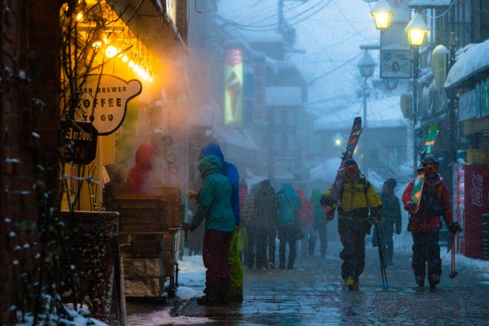
After a full day of powder skiing, KC Deane and Mattias Evangelista head for the other half
of an international ski trip: the après scene.
Grant Gunderson, both photos
Local Beta
“Even when you do have favorable avalanche conditions, the locals will know that there’s still always certain places that you avoid,” says Banks. Just like in your local range, the challenge is weeding out the expert information from the over-enthusiastic novice. Banks and Rasiah both suggest starting by looking at internationally recognized certifications. This includes internationally certified mountain guides, like Banks, or those certified by their national governing guiding organizations, like Rasiah.
“Make sure that that guide that you’re hiring is certified from a reputable body, and that country’s guiding association has a good program in place for the way that that guide is going to guide,” says Rasiah. He adds that he’s worked with very talented non-certified guides as well but has had to vet them more before hiring them. “There’s lots of guides that either haven’t had the opportunity to get certified because of where they live or what country they’re from, and they really know their stuff.”
Even for experienced backcountry skiers, sometimes hiring a guide is the best way to learn about a new place. “I very much do not hesitate to hire guides, even as a guide, when I go to a new location to have them show me around,” says Banks. While hiring a local professional for your whole trip will give you the best chance of finding the best skiing, just having someone show you around for a day or two at the start of your trip is still beneficial.
“I think a lot of people don’t understand that, when you hire a guide, you can really specify what it is that you want to get out of that guided day,” explains Banks. Local, knowledgeable guides can share snowpack history, pieces of terrain to avoid and local etiquette. When booking your day out, make sure to communicate that you want an educational day out to prepare you for the rest of your trip. As Banks points out, “Depending on who your guide is, they may or may not be willing to share that information, but oftentimes they’re definitely willing to share snowpack information.”
If the extra steps of tracking down snow and weather data, making a robust run catalog and researching local search and rescue in a foreign language sounds like more than you signed up for, then follow Banks and Rasiah’s lead when planning your next international ski trip. Hire a professional guide familiar with the area. They’ll do all the trip planning for you, bring you to the best terrain and find the best snow.
This article was originally published in Issue 167, The Hidden Issue. To read, grab a copy, or subscribe to read our stories when they’re first published.
Related posts: