Pacific Northwest skiers are a mellow lot, but if you want to get them riled up, just ask about the so-called “Seattle Skintrack.” This moniker refers to skiers who travel from the city to set a steep zigzag straight up one of the many runs that dump into Bagley Lakes Basin, located in the vicinity of Washington State’s towering Mt. Baker volcano and its ice-clad neighbor Mt. Shuksan. But as locals grow frustrated with the influx of traffic, Seattle-based pro guide Matt Schonwald found opportunity for growth.
In fact, Schonwald doesn’t think this skintrack train of weekend warriors poses an inconvenience for Mt. Baker backcountry regulars. His reasoning: while some may enjoy lapping the Bagley Basin terrain, there’s a host of other descent options ripe for the picking—all accessible with just a little effort. Schonwald has taken it upon himself to document these other options in his book, A guide to Mt. Baker, published byOff-Piste Ski Atlas, famous for their water- and tear-proof aerial photo guides. The guidebook, released in November and also available via a digital version on Rakkup, is Schonwald’s second for Washington State, following his guide to Snoqualmie Pass, released in February 2017.
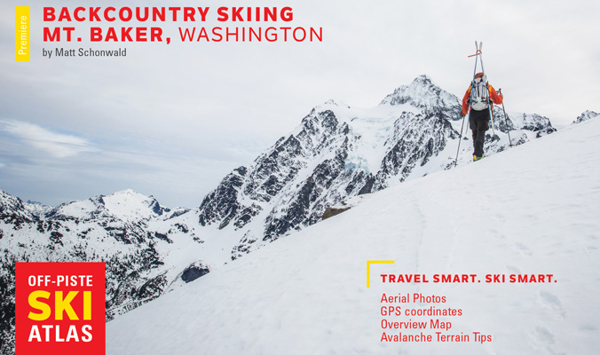
The cover of Shonwald’s new guidebook to the Mt. Baker backcountry.
With the Mt. Baker Ski Area reporting the deepest all-mountain snowpack in the U.S. for most of this winter, there’s no doubt that plenty of cars sporting the Baker-indicating “Go East” bumper sticker are heading to a zone made famous by the 1998-1999 season, when the resort’s whopping 1,140-inch total set a world record due to a two-week stretch where Baker got nineteen-and-a-half feet of snow. It’s clear that most years, there’s plenty of fresh to go around.
And while not every season breaks records, Schonwald sums up Baker’s conditions as “consistent snow that’s consistently deep”, likening the zone to the similarly coastal Chugach Mountains. “You can ski the most obscenely rowdy terrain and have snow on it,” he muses.
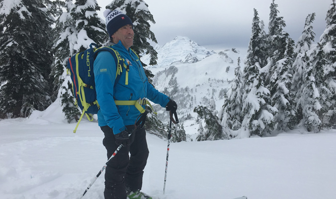
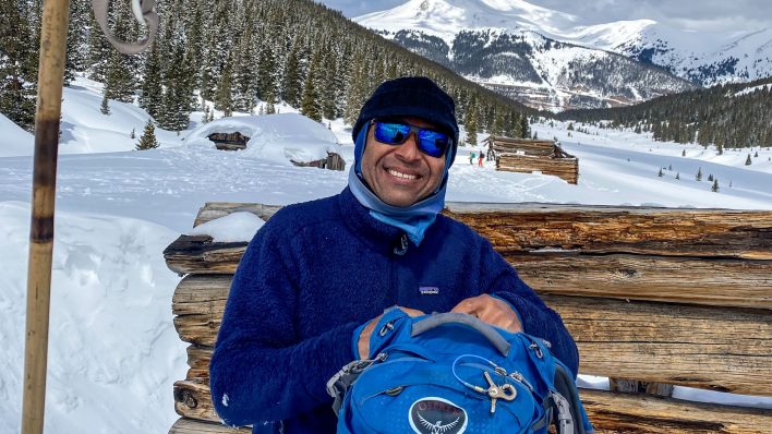
Schonwald in his natural Mt. Baker environment. [Photo] Greg Scruggs
“Within an hour of the trailhead you have access to three-to-four dozen distinct lines of varying lengths, difficulty and exposure,” Schonwald explains. And at just three hours from Seattle and 90 minutes from Bellingham, he places the Baker backcountry among the best in North America when measured by a terrain-for-access equation.
Unlike other Cascade Range destinations where trailheads start deep in the Evergreen State’s forests, Route 542 travels high enough to reach near treeline. That extra elevation makes all the difference for Schonwald, who argues that unlike other Washington zones, touring around the Baker Ski Area “is not huge, but it’s open.” As a result, there are features, rolls and convexities all packed together that allow a mellow 34-degree slope and a gnarly 50-degree couloir to coexist. He describes a typical Baker panorama as “a distinctive chute next to a tree-lined rib with a cliff, and then next to the cliff is another glade”—all within 100 feet of each other and a backdrop of two iconic peaks.
Schonwald was around for the 1998-1999 skyscraper-burying season, working as a patroller at Crystal Mountain in the southern Cascades. He recalls being “elated and exhausted all at the same time,” and remembers being chased off Shuksan Arm by ferocious avalanche danger that year.
Those Shuksan Arm days contribute to the tally of more than 100 days in the backcountry he’s racked up over 20 years in the Mt. Baker bc zone, which has allowed him to detail areas in the guidebook like Swift Creek, Mazama Bowl, East Table, Herman Saddle, Chain Lakes, Huntoon Point and Ptarmigan Pass. He believes that documenting these areas will help steer crowds away from lemming-like laps of Bagley Lakes on crowded days. He also offers tips for spring and summer ski-mountaineering ascents when climbing high enough affords views of the Strait of Juan de Fuca, the channel that separates Vancouver Island and the Olympic Peninsula and sends moisture east up the Nooksack Valley onto Baker’s flanks.
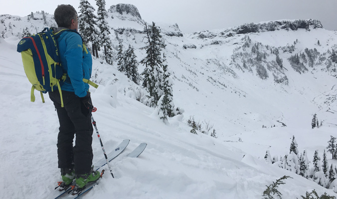
Schonwald looks out onto Bagley Lakes Basin below Table Mountain. [Photo] Greg Scruggs
He’s particularly excited that an extended version of his guide is also available digitally on Rakkup with tools that allow users to overlay the day’s avalanche forecast onto the guides to filter out potentially dangerous runs. He does concede that when it comes to the Seattle Skintrack, he believes skier collisions on high-traffic days are more of a risk than avy danger, and he makes that point clear in boldface type in the guidebook.
Climbing the ignominious route, he says, “is kind of like driving the wrong way on a one-way street—maybe you can do it because there’s no car coming, but if you do it, you’re not necessarily doing anyone any favors.”
Schonwald hopes his book will not only provide more options for those looking to get away from the fray, but that it will keep skiers moving in the right direction—both uphill and down—while exploring the Mt. Baker goods.
Gregory Scruggs lives in Seattle, but he prefers to believe that Mt. Baker’s true skintrack culprits are Bellingham Bozos.
—
Correction: In a previous version of this article, the Highway listed was Highway 520. It has been changed to Highway 542, the correct number for the Mt. Baker Highway in Washington State.
This guidebook has many inaccurate and borderline negligent routefinding “tips” for some of the most common routes. IMO guidebooks can be valuable if they are accurate, but hazardous if not. This one is the latter.
Btw, the Mt. Baker Highway is 542, not 520.
Agreed, like the drawing of the safety line on shuksan arm being incorrect and in unsafe avalanche area above the large waterfall cliffs.. Pictures are also misleading and not true to perspective, many wtf’s with these as some spots were unrecognizable from actual experience on the ground. I think they were bought from someone else who shot them from an airplane.
Nothing sells a guidebook like a Seattleite naming the wrong the highway number for the highway the book is supposed to be about.
The information in this book is wrong, but that’s what ski touring in an area 5 times a year and then deciding to write a book about it will get you.
Must be PTSD from 520 bridge traffic, that was my bad. Note, however, that the guidebook’s author has logged 100+ days in the Baker backcountry.
I can appreciate that names for certain lines can vary, but after 100+ days in the Baker BC there’s no excuse for the amount of dangerous misinformation in this guide.
Drawing more JONGS into bakers terrain with misinformation is a great plan.
Please keep the guide book writing to negligent and half-assed. Locals everywhere appreciate you not giving away any stashes.
A guidebook can tell you where to go but not when it’s safe to be there or make the observations necessary for safe decision-making analysis.
Where I live, we Define a “carpetbagger” as anyone who comes into a local mountain area, poaches the local skin tracks and then either writes about it for money or posts the information on a trip report for ego or self-promotional gains.
A guidebook can tell you where to go but not when it’s safe to be there or give you the experience and education needed to make the unbiased risk analysis that is required for a safe tour.
By the time you have those skills, you won’t need to be guided by a guide book.
As can be seen by the above comments, guide books generally tend to create conflict within local mountain communities as Mother Nature is turned into a commodity and sold to the highest bidder.
Maybe think about all you guys skiing pow on the arm on a sunny day in front of all the wannabes riding chair 8. That has nothing to do with creating a more appealing ski experience in backcountry terrain to all those JONGS. They are skiing chopped junk at the ski area while you are slaying freshie.
You are dangling the carrot in front of their faces just as bad as any guidebook.
That and being a part of the ski media industrial complex. Hell some of you make $$$ hawking photos of backcountry pow for the public to get all amped about. Then get all bitchy when people want to go backcountry skiing.
Hypocrites.
It’s not a big deal. Get over it. You are just rich white kids anyway.
“Rich white kids”? Is that a joke? Have you ever actually spent time in Glacier or interacted with Baker locals? Most of us are working minimum-wage jobs, barely getting by, so we can spend the whole season skiing. The rich people are the weekend warriors from Seattle.
No one is skiing the Arm because they’re trying to look cool in front of people on Chair 8. And one or two photographers selling photos is in no way representative of us locals as a whole, and it’s ridiculous to insinuate that. The backcountry spots are learned through years of being here and skiing with other locals. We just think it sucks that someone has decided to spill the beans to those who haven’t earned it.