In the time since January 30, there has been a nearly unprecedented amount of tragedy in the mountains. Avalanches have now claimed more than 20 lives in less than a month, with many more close calls reported nationwide and the season’s total number of fatalities outpacing the 10-year average. In the vast majority of forecast zones, a weak snowpack has combined with a pandemic-driven uptick in backcountry use and excitement over fresh snow after prolonged dry spells. And as winter continues to gain momentum, avalanche centers are pushing through these challenging circumstances to communicate the risks of traveling in avalanche terrain through their daily forecasts.
“We’re seeing a lot of reading and forecaster fatigue,” says Nikki Champion, a forecaster for the Utah Avalanche Center who focuses on the Salt Lake, Provo and Ogden areas. “It gets hard…people reading the same messaging every single day and the same problem and taking it into account that it’s just as dangerous as the first day.”
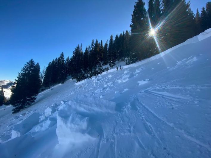
Like most western states, Utah saw late-November snow followed by a two-week drought. Snowfall remained light through December into January, and it wasn’t until the past few weeks when deep storms started hitting the area. Last week’s storm totals topped seven feet in some areas, triggering a widespread avalanche cycle and Wednesday’s extreme forecast in the central Wasatch. And while this new snowfall has been great for powder-starved skiers and riders, the early season snow continues to present issues. “We have weak, faceted snow basically on all upper elevations west through north through east and all the way down the southeast,” says Champion. “So only true south at this point is not holding that weak, early season faceted snow.”
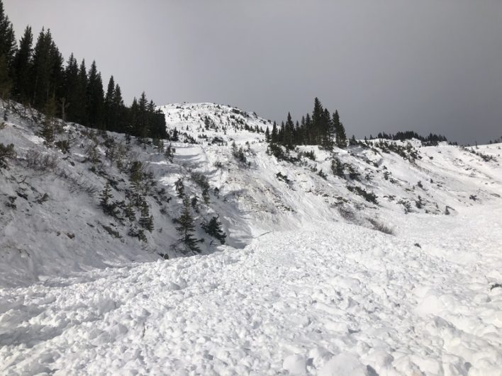
At this point, Champion says that the faceted, weak layer of snow is over a foot thick and sitting beneath many feet of newer snow, and with recent high winds that depth can top five to 10 feet in wind-loaded areas. “On these really firm slabs there might not be any collapsing, and it could allow folks to get farther onto a slope before it fails. Any of these avalanches that fail—whether it be persistent weak layers or new snow—are likely to step down into that weak snow,” warns Champion, who adds that there are been several avalanches that have failed either at or near the ground recently. This includes the February 6 Wilson Glades avalanche, which claimed four lives and failed about a foot above the ground in a faceted layer on top of a thin melt-freeze crust. Below the crust were more facets all the way to the ground.
Only significant snowfall that deeply buries the facet later or warm spring temperatures to heal the snowpack will provide reprieve from this danger. “We’re dealing with early season snow still into February, and it’s still a really weak base to our snowpack, so I see it lingering around for a while,” Champion warns.
This problem, however, is not localized to the Salt Lake, Provo and Ogden areas where Champion works. She says other forecasters have been seeing it throughout Utah, specifically in the Logan area and the Unita Range. Plus, other states’ forecast centers are reporting similarly weak snowpacks.
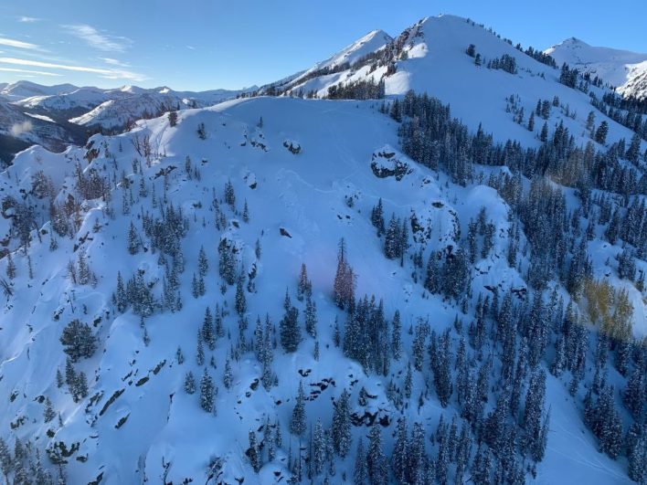
Brian Lazar, who forecasts for the Colorado Avalanche Information Center, confirmed that a persistent weak layer is plaguing the entire state. “It’s not unusual for us to have persistent weak layers in our snowpack, but the weak layers this year are particularly worrisome and reactive,” says Lazar, who attributes this “once-in-a-decade” snowpack to a similar weather pattern as what was seen in Utah: lingering, early-season snow followed by prolonged dry spells, which promoted the growth of weak snow on the surface, all of which has been buried by recent storms.
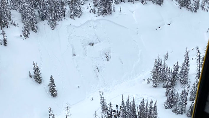
“Now that the snow has arrived,” Lazar says, “avalanche actively has really picked up, and with these recent storm events, we’re starting to connect the slabs across larger swaths of terrain.” A February 1 avalanche on Ophir Pass that caught four skiers and killed three was one such slide, propagating 1,000 feet across the slope, running 1,500 feet down slope and causing two smaller sympathetic releases.
With all this in mind, Lazar’s advice for backcountry travelers—especially experienced skiers and riders who have built habits over numerous years—is crucial: “Things that work and that are safe in most years are showing themselves to not be safe this year,” he says. “You need to really rethink what you’re doing. Start from square one and select terrain and develop travel plans that are appropriate to these once-in-a-decade conditions.”
This means widening margins of safety, giving larger buffers to avalanche-prone terrain (Lazar notes that avalanches have been remotely triggered as far as 800 to 1,000 feet away) and keeping decision-making conservative.
As for healing the snowpack, Colorado’s path to stability could take a few different routes, all of which will initially make the snowpack weaker and more dangerous. A single, massive loading event could cause widespread avalanches and give the snowpack a fresh slate; small incremental storms could slowly bury the weak layers, lowering the likelihood of triggering avalanches but increasing consequences; or springtime warming, which would promote wet slides before healing the snowpack. “There’s no magic bullet to get out of the scenario we’re in,” Lazar says. “Some of these ingredients are baked, so to speak.”
While Wyoming’s Tetons experienced dry spells similar to Colorado and Utah, the weak layers formed in the range’s snowpack during those time periods are not as widespread or as pronounced, which has made it harder for the Bridger Teton National Forest Avalanche Center to predict when and where they’ll be active. “This year we had [early season] snowfall, and it was starting to look like a stable base,” says forecaster Lisa Van Sciver. “Then we had a prolonged dry period, and the variability of where those weak layers formed is what we’ve been dealing with this season.”
Wyoming has recorded four avalanche related fatalities this season, the first two of which involved snowmobilers. On February 19, Wyoming reported its first non-mechanized fatality when as snowboarder was buried in a drainage while sessioning a jump with five friends. The group was north of Grand Teton National Park on Togwotee Pass.
“The slope history is going to vary so much, especially as you get into the steeper peaks, because there are so many avalanche cycles that we don’t know about,” notes Van Sciver. The valley sees more sunny days than the range’s upper elevations, meaning that avalanche crowns are oftentimes filled in before forecasters can see them, making it difficult to track avalanches in a zone and leaving a gap in forecaster data.
“You theorize what’s occurring with the snowpack and the weather, and not really knowing how many slopes have slid during these avalanche cycles that we’ve seen this year [makes it] really hard to forecast how those deeper persistent weak layers will react,” Van Sciver says. “But, of course, they could wake up in a warmup in the spring.”
One challenge that Van Sciver sees users having to navigate is the high number of people in the backcountry. “I think the most important thing people need to keep in mind these days is that, as areas become busier, there’s more parties out there,” she says. “Triggering avalanches could have different consequences than just knowing that your own party’s safety. Situational awareness in the mountains is super important, and now we have a new added part where we have to be extra aware of where other people are traveling.”
This occurred with the fatalities in Utah’s Wilson Glades, when two parties were both traveling uphill and caught in the same avalanche. On January 31, a group of four skiers were all caught and carried by an avalanche on Olive Oil, a peak near the southern boundary of Grand Teton National Park, Wyoming. The entire group survived, but one was airlifted out of the scene due to a leg injury.
While Utah, Colorado and Wyoming areas have all been dealing with lingering early season snow turning into weak layers, New Hampshire’s Presidential Range had enough early season snow to ski at the upper elevations. “People were skiing Right Gulley in, like, October, right?” says Mt. Washington Avalanche Center forecaster Frank Carus. “And then, all of a sudden, it got warm and that was over.”
According to Carus, New England didn’t start seeing enough snow to open up the lower-elevation glades until later in the season, which caused skiers and riders to turn to steep, avalanche-prone slopes up high: “We’d get one to three inches in our forecast period, but that piles up, up high, and people weren’t getting anything down low. So people were pushing up into the terrain because they had no options.”
Carus says the greatest concerns to the region’s snow stability are the crusts that formed during the prolonged dry spells and have since been buried by massive wind slabs. On February 1, a solo skier was killed in an avalanche on Mt. Washington’s Ammonoosuc Ravine and, according to the MWAC’s final report, the initial avalanche that buried the victim was likely a wind slab that slid on a wind crust formed by 157-mile-an-hour gusts the week prior.
“We should always be careful to watch those crusts and some of the low-probability, high-consequence events that we see from time to time. Some crust is going to release. It’s going to facet and make a weak layer,” he explains, adding that mid-season rain and warming events typically reset the snowpack. “We continue to have a lot of spatial variability in our snowpack, and we haven’t had a true reset in a long time. Like we didn’t even get the January thaw, particularly.”
As for how to plan around these weak layers, Carus echoes the thoughts of Champion, Lazar and Van Sciver, advising that skiers and riders rethink the ways in which they travel in the mountains this season to account for more severe conditions and a growing number of users.
“I think the main thing that people need to keep in mind is to really closely look at all your resources for the days leading up to your trip, and then chose what you’re going to do based on conditions, not on your schedule,” Carus says. “Just because that’s your one day off doesn’t mean that’s the right day to go poking around into a big line.”
Support the Utah Avalanche Center
Support the Colorado Avalanche Information Center
Support the Bridger-Teton National Forest Avalanche Center
Related posts: